TRAILS
Trails in Iowa promote health, community connections, and economic growth. They offer safe spaces for physical activity, improving health and quality of life, while linking towns, parks, and natural areas. Trails also boost tourism and local economies, support small businesses, and encourage environmental stewardship, making Iowa a vibrant and welcoming place to live and visit.
Total value of trail grants facilitated by COGS
in the last three years:
$37,948,856
Area 15 Regional Planning Commission
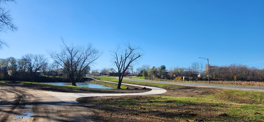
The Oxbow Lagoon Link Trail project, located in Ottumwa, IA, is designed to fill a critical gap in the city's trail system by connecting the Greater Ottumwa Park, Oxbow Lagoon, and the Milner Neighborhood Trail.
This 5,260-foot trail will enhance access to recreational areas, local businesses, and residential neighborhoods. The project includes 2,560 feet of new trail along the Oxbow Lagoon, 2,700 feet within Richmond Avenue and Church Street right-of-way (ROW) and 400 feet of reconstructed trail behind Church Street. The trail will be 10 feet wide along the lagoon and 8 feet wide in the ROW areas, with detectable warning strips at crossings for safety.
This new trail will improve pedestrian and cyclist connectivity between neighborhoods, parks, schools, and local businesses, encouraging outdoor recreation and promoting healthy living. Key partners involved in the project include the City of Ottumwa, Wapello County Trails, and Area 15 RPC.
Bi-State Regional Commission
The Bi-State Regional Commission wrote a successful Iowa Transportation Alternatives Set-Aside grant for the City of LeClaire. The Mississippi River Trail – Eagle Ridge Road to May Street project will include the construction of a 4,500-foot long, 10-foot wide ADA accessible multipurpose trail along U.S. 67/Cody Road from Eagle Ridge Road to May Street in LeClaire, IA. This project is part of the Mississippi River Trail where it links with a widened sidewalk connecting to the historic downtown and levee district. The trail will provide connectivity to the Interstate 80 bridge which will include a bicycle and pedestrian accommodation on a newly reconstructed bridge in a few years.
Bi-State staff helped coordinate discussions to ensure the new interstate bridge would include a trail accommodation. The Iowa DOT and the City of LeClaire were key partners in this project.
East Central Iowa Council of Governments
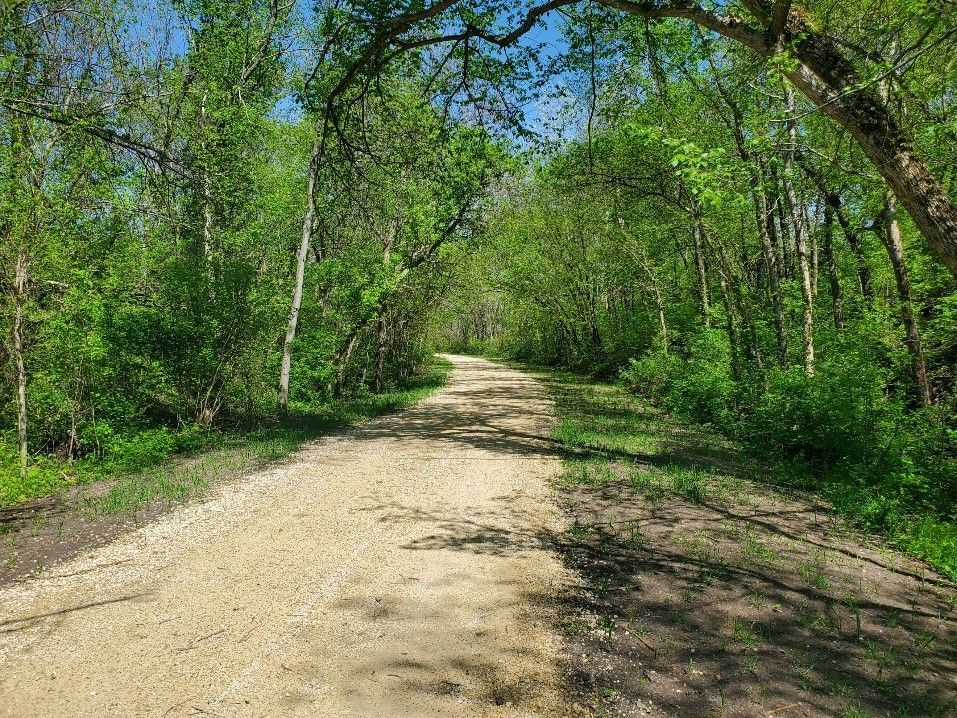
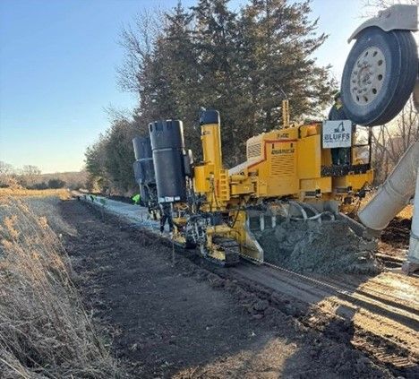
Linn County Conservation received Regional Planning Affiliation 10 (RPA 10) Transportation Alternative Set-Aside Program (TAP) funding to complete grading and install drainage structures for a grass trail segment of the Grant Wood Trail from Secrist Road to Paralta Road. Hard surfacing will be added later.
Future regional segments will extend the trail to the City of Springville and to historic features and completed trail segments in Jones County and beyond. The Grant Wood Trail project from Secrist Road to Paralta Road project is one of six trail projects funded in RPA 10 within the past three years.
Iowa Northland Regional Council of Governments
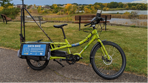
We are transforming maintenance through cutting-edge data technology. In a groundbreaking effort to promote sustainable infrastructure, INRCOG staff leveraged the Des Moines MPO’s innovative Iowa Data Bike to evaluate trail pavement conditions throughout Black Hawk County.
This cutting-edge bicycle is equipped with advanced instruments to measure pavement quality and capture high-resolution imagery. Over several weeks, INRCOG staff biked miles of trails, collecting detailed data to provide a comprehensive overview of current conditions. The findings were analyzed and integrated into an Interactive Map, offering users an intuitive way to explore trail conditions across the county. This tool not only highlights areas needing immediate attention but also serves as a resource for local jurisdictions to craft long-term, sustainable maintenance strategies. By leveraging technology and collaboration, this project demonstrates INRCOG’s commitment to enhancing the longevity of regional trails and ensuring safe, enjoyable spaces for the community to walk, run, and bike.
North Iowa Area Council of Governments
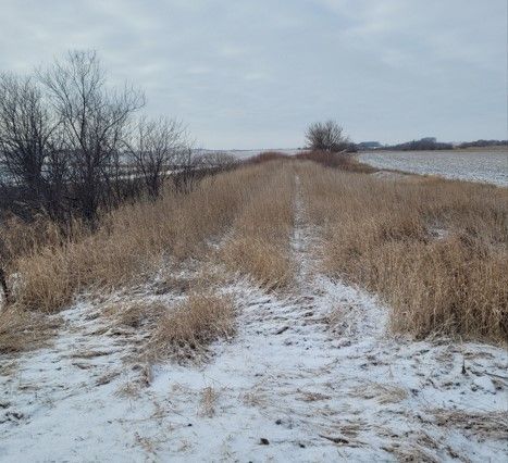
The Prairie Land Trail is a trail project in Cerro Gordo County's twenty-one mile trail corridor that begins at Cerro Gordo County's largest population community, Mason City, to the southwest corner of the County to and beyond the community of Meservey where it will connect to Wright County and the trail to Belmond. This trail will give rural residents and the residents of the small communities that it passes through a safe place to recreate that is away from motorized vehicle traffic. As fourteen miles of this trail corridor have been completed, observations have noticed an increase in the number of users.
Key partners on this trail project include: Cerro Gordo County Conservation, Cerro Gordo County Board of Supervisors, RPA 2 Tap City of Swaledale, City of Thornton, City of Meservey
Northwest Iowa Planning & Development Commission
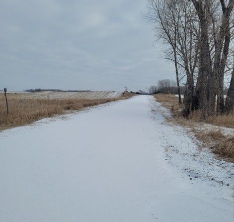
The Iowa Great Lakes Connection Trail is a 4.2-mile dedicated trail traversing rural Clay County and connecting the Cities of Spencer and Fostoria with the Iowa Great Lakes Trail in Dickinson County. This trail was completed in the summer of 2024 and fulfills a 35-year dream of connecting Spencer and Fostoria with Iowa Great Lakes and all of its connecting systems. The entire trail system now provides: connection to eight additional communities, ten natural lakes, scenic river corridors, hundreds of acres of public open space/wildlife management areas, six State parks, two county parks, 15 city parks, eight public beaches, historic Arnolds Park Amusement Park, Majestic Pavillion, Roof Garden Ballroom, State Pier/Queen II vessel, Maritime Museum, Abbe Gardner Sharp Cabin, museum & Spirit Lake Massacre burial site, camping, public fishing access, shopping, hotels/motels and restaurants. Totaled, the entire system is over 60 miles of paved routes and an additional 45 miles of dedicated trails.
Region 6 Resource Partners
Region 6 Resource Partners has been actively involved in the Iowa River’s Edge Trail rail-to-trail conversion, which spans approximately 34 miles from Marshalltown to Steamboat Rock. Their contributions include project planning, grant writing, securing regional trail funding, and administering grants to support the project’s progress.
The City of Marshalltown owns the 15-mile corridor within Marshall County. Through various funding sources, the city has completed 2.81 miles of paved trail, with plans for an additional 2 miles currently underway. However, progress between Marshalltown and Albion has been slowed due to the poor condition of numerous bridges in the Iowa River floodplain.
In Hardin County, where the corridor is owned by the county, the bridges are in much better condition. The county has successfully completed 5 miles of trail between Steamboat Rock and Eldora, with an additional 5.5 miles planned from Eldora to Gifford. Completing the entire trail will require sustained effort and collaboration across many years and multiple funding sources.
Siouxland Interstate Metropolitan Planning Council
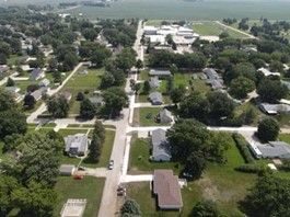
The City of Marcus constructed their Community Trail project this summer, after about six years of fundraising. The project was spearheaded by the Marcus Trail Committee, an organization run by extremely dedicated volunteers who coordinated with the city and the Siouxland Interstate Metropolitan Planning Council (SIMPCO) to identify and apply for numerous funding opportunities.
They also organized community fundraising events, such as 5k color runs, t-shirt sales, outreach at local events, and other engaging activities to drive donations. SIMPCO had the joy of contributing to this project with the distribution of Iowa DOT Transportation Alternatives Program (TAP) funding as well.
This project was truly a grassroots effort, with contributions also coming from the City of Marcus, numerous local businesses, the Cherokee County Foundation, and many private donors.
Southeast Iowa Regional Planning Commission
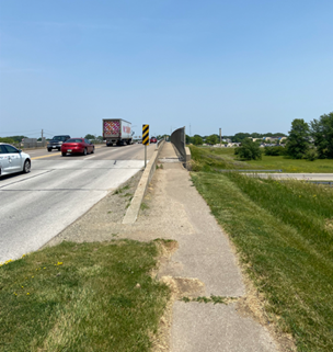
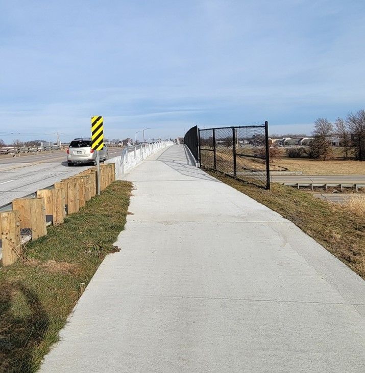
The cities of Burlington and West Burlington, in partnership with Des Moines County, collaborated on the Greater Burlington Bicycle and Pedestrian Plan, led by the Southeast Iowa Regional Planning Commission (SEIRPC). A key priority was developing a trail along Gear Avenue in West Burlington to improve connectivity and accessibility.
The US 34 freeway passes under Gear Avenue, creating significant challenges for pedestrians and cyclists traveling between the mall and the college. The existing 5-foot-wide sidewalk on the east side of the bridge ended abruptly at the stoplight north of the interchange. Pedestrians were left navigating a narrow, crumbling path squeezed between a concrete traffic barrier and a chain-link fence overlooking the freeway. Beyond the bridge, they faced walking through grass, descending a steep hillside, and crossing a deep drainage ditch to reach the mall's ring road.
For cyclists, the situation was even more dangerous, as the narrow sidewalk was unusable, forcing them onto a roadway with over 10,000 vehicles per day. Recognizing these safety concerns, SEIRPC and the Iowa DOT began developing a strategy to address the gap, exploring options such as a pedestrian bridge and improved safety barriers to create a seamless and secure trail connection across Highway 34.
Southwest Iowa Planning Council
Southwest Iowa Planning Council (SWIPCO) is in the midst of a large trail mapping project to benefit Regional Planning Affiliate 13 (RPA 13) which consists of Cass, Fremont, Montgomery, and Page Counties.
SWIPCO has contracted with Golden Hills Resource Conservation and Development on a trail mapping project to create new and accurate trail maps and get 360-degree imagery of the trails to upload to online mapping sites. This will allow the public to be better informed of the trails available to them and become more comfortable with what they will experience on those trails.
This project is funded by RPA 13 regional funds provided by the Iowa Department of Transportation, with the goal of increasing trail usage across the region.
Over the past three years, SWIPCO has supported several other trail initiatives. The cities of Clarinda and Stanton have completed new trail construction, and a major project by Southwest Iowa Nature Trails, Inc. has secured funding for the Wabash Trace–Rapp Park Connector Trail in Shenandoah. These efforts have been made possible through RPA 13’s Transportation Alternatives Set-Aside Program, demonstrating a strong commitment to expanding and improving the regional trail network.
Upper Explorerland Regional Planning Commission
UERPC partnered with stakeholders in northeast Iowa to study the economic impact of trails. Planners collected data to identify the spending of a “target group” (adult, non-local, primary-purpose trail users) and ran an input-output model to show the greater economic impact to local communities. The analysis showed, for example, that the annual economic impact from Decorah’s Trout Run Trail is nearly $13 million.
Stakeholders in the region immediately started using the study in grant applications and to demonstrate to decisionmakers the value of trails. As word spread, trail advocates and COGs from around the state reached out to UERPC about utilizing the study’s findings to strengthen grant applications and promote trails in their communities. IEDA also learned of the study, highlighting it in their statewide newsletter and adding it to the Travel Iowa website as a statewide resource.
The full analysis and detailed methodology are available on UERPC’s website.